
Trace an Avon Lake Street
An Avon Lake street search works best as a chain of address-keyed records, not as a roster. The Lorain County Auditor provides the address-facing starting point. Its public search control accepts a parcel, owner, or address. From there, the parcel number, often called a PPN, connects the current property context to the Recorder's recorded-instrument path. The Recorder does not document a simple address search. Its guide instead directs users through party name, parcel number, date, legal filters, or an instrument reference. Treat every name as evidence tied to a particular record, rather than proof that a person lives there now.
- Enter the full address in the Lorain County Auditor property search and copy the PPN exactly as displayed.
- Use the current owner or PPN to begin the recorded-document trail at the Lorain County Recorder.
- In Recorder Advanced Search, clear name inputs, remove all PPN dashes, select Detail Search, and open the selected Instrument.
- Record only the visible legal description, recording date, and predecessor party, then repeat with the earlier party or parcel path.
- For an already identified person, use the Lorain County Voter Information Search as an individual check, not as a by-street list.
- Ask Avon Lake Public Library staff to check the relevant historic directory year, press files, and maps for an earlier household lead.
City permit, inspection, zoning, and engineering material can add a dated project or approval clue. It is a request or counter channel, though, not a verified public permit-history search. Use the street address, the kind of record, and an approximate year when asking the city whether a retained file is available.
Note: Keep the address, parcel number, record date, and source name together so separate property and directory clues are not mistakenly merged.
Avon Lake Street Directory Starts
The Auditor is the practical first stop for a modern Avon Lake street directory trail because its landing page expressly offers a combined search by parcel, owner, or address. The stable fact is the starting control, not an assumed set of parcel-card fields. A detailed current result could not be safely inspected during research, so a mailing address, valuation, exemption, transfer, or tax label should be checked on the live card before it is relied on. One address can point to a parcel record without showing every occupant or proving a current household.
| Auditor control | Type | Verified use | Limit |
|---|---|---|---|
| Search by Parcel, Owner or Address | Combined text search | Starts an Avon Lake property or address query | Required-entry rules were not stated |
| SEARCH | Button | Opens the property-search route | Detailed result fields were not verified |
| MAP | Navigation button | Routes to the GIS Parcel Viewer | Live viewer mechanics need confirmation |
| Sales Reports | Tool link | County sales context | Not a household record |
| Tax Estimator | Tool link | Tax-estimate route | Not a resident search |
An official Board of Revision detail example shows why assessment geography needs careful reading: labels can name subdivisions, condominium phases, or assessment areas. They are useful parcel context, not postal neighborhoods or a civic directory.
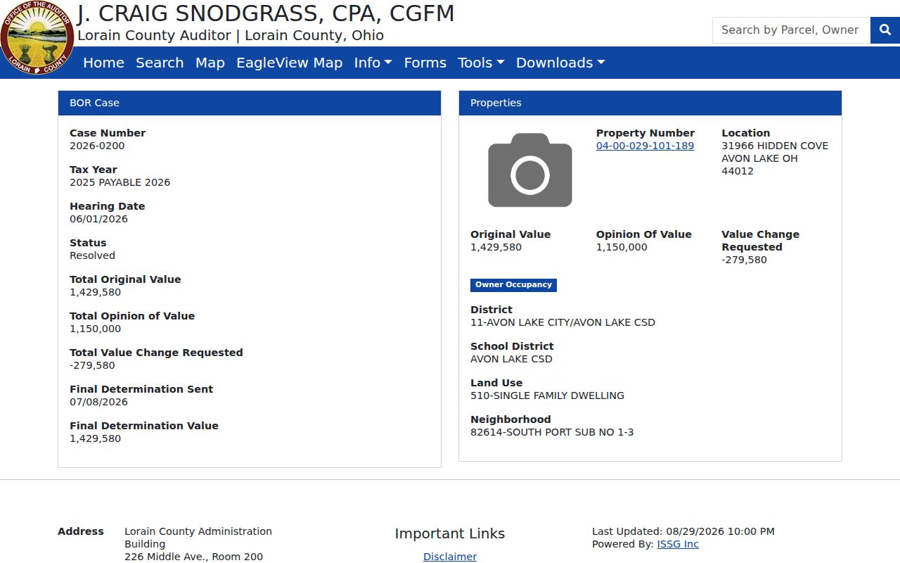
Use an assessment-area label to understand the parcel setting, then confirm the actual address and current record through the Auditor's live search. Avon Lake Board of Revision labels should not be treated as neighborhood boundaries.
Avon Lake Address Document Fields
The Recorder supplies the document layer for an Avon Lake address trail. The Recorder's property-search guide says the database searches by name, parcel number, and date, with an account required through DTS Public Access. Its default Name Search uses legal last and first names. Parcel work belongs in Advanced Search after clearing the name boxes. The official guide also documents legal filters and a separate instrument path. It does not publish a verified online-start date, so a failed online result should lead to a counter or archival question instead of a guessed coverage date.
| Recorder field or action | Mode | Format or use | What is verified |
|---|---|---|---|
| Legal last name / first name | Name Search | Legal-name inputs | Default search path |
| Parcel | Advanced Search | Enter the PPN with all dashes removed | Use after clearing name fields |
| Date / Recorded Within | Search criterion | Restricts the date path | Detailed date interface was not exposed |
| Categories / Document Types | Advanced or Legal filter | Optional selector | Option list was not exposed |
| Instrument ID or Book / Page | Instrument mode | Reference-based document search | Instrument opens the selected image |
Lorain County Recorder
226 Middle Avenue, Room 102, Elyria, OH 44035
440-329-5148
Monday through Friday, 8 a.m. to 4 p.m.
DTS Public Access
Lorain County Auditor
226 Middle Avenue, Room 200, Elyria, OH 44035-5641
440-329-5207
auditor@lcauditor.com
Property search and MAP
Recorder counter staff are the appropriate follow-up when a title chain reaches an older book or index. The Auditor announced Friday counter closures beginning February 6, 2026, so confirm counter access before travel.
Note: The Recorder guide does not state an online start year, so a missing web result needs an office or archive follow-up.
Avon Lake Street Maps Need Checks
Mapping is a spatial check, not a substitute for the property or deed record. The Auditor routes MAP to the GIS Parcel Viewer, and the county publishes a GIS Mapping information page. Research did not verify the live viewer's search fields, parcel-click details, layers, buffer tools, or adjacent-parcel behavior. Do not assume those controls exist from an older screen or from a different ArcGIS site. Compare a mapped parcel with the address and PPN already found in the Auditor record.
The county GIS Mapping page is the official route for the parcel-map channel.
The Auditor has announced a GIS software upgrade and said that parcel splits and combinations were complete only through mid-May 2026 when the notice was posted. A new subdivision, recent split, or changed street should be checked with the Auditor or Tax Map staff.
The city's map page adds a second local caution. Its main map artwork dates from May 2020 and warns that newer streets are not shown. Use a ward or zoning map for context, but use the current parcel channel for an address decision.
Avon Lake Permits by Address
Building, inspection, planning, zoning, and engineering files can date work at an Avon Lake address. The city directs applications, status checks, payments, and questions to Access Our Avon Lake, but no public historical address search was verified. A focused Ohio Public Records Act request to the city is the safer route for an older file. Identify the project location, likely year, and whether the request concerns a permit, inspection, plan, or enforcement material. The city may need to review records for redaction before releasing them.
The commercial fire construction permit page illustrates an application record rather than a searchable archive.
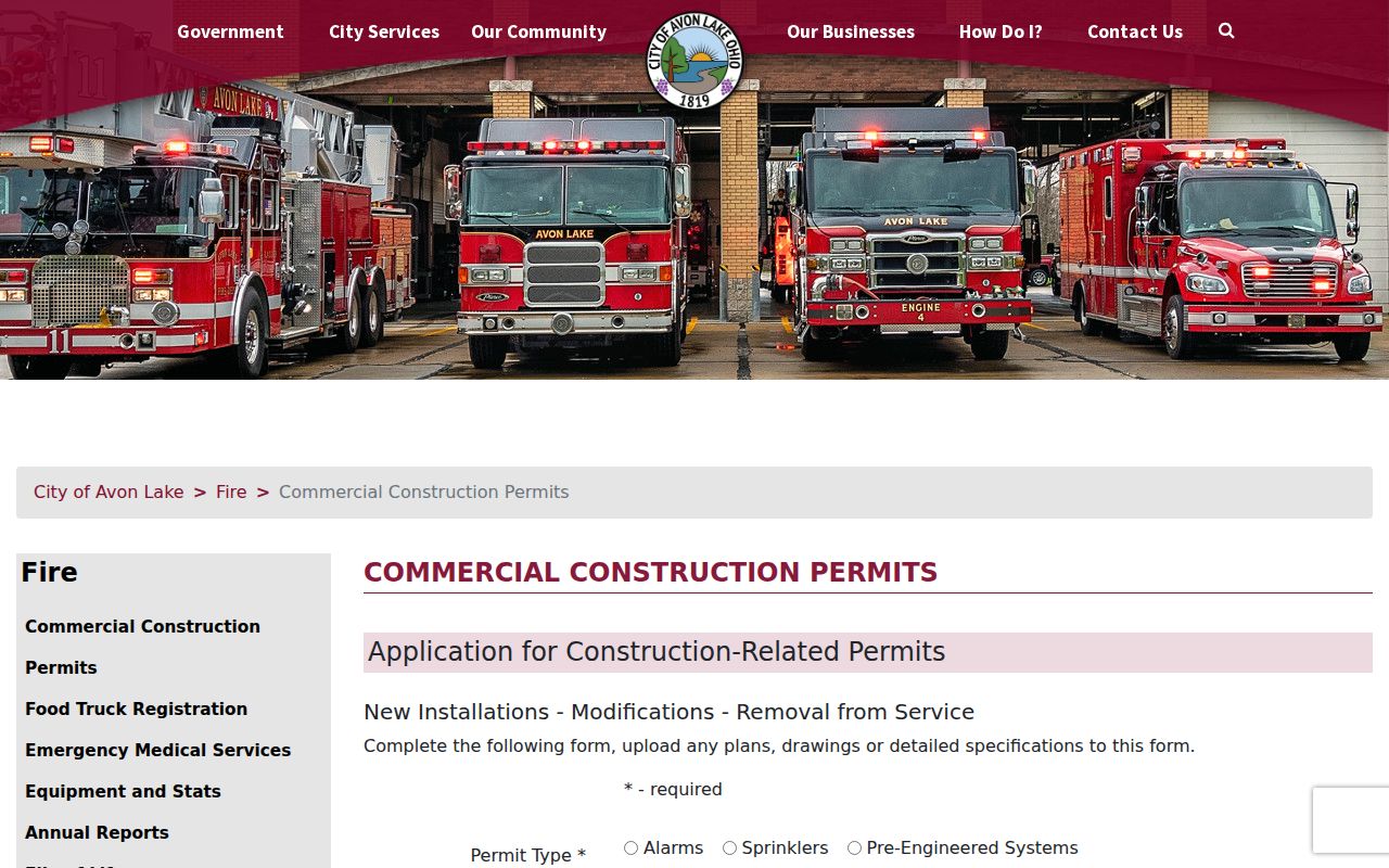
The form shows that project records can contain location and work information, but it does not establish that a completed permit is openly searchable by street. The Building Department is at 750 Avon Belden Road, 440-930-4102.
Avon Lake Street Record Coverage
Each address-keyed source answers a narrower question. Chaining them makes a street directory search more useful while keeping the limits visible. The property roll anchors the parcel. Recorded instruments provide the land-document sequence. Maps place the parcel. City files can document a project or approval. Library material can supply historic leads. Voter records have statutory public-access channels, yet the public tool is designed for individual verification and protected information remains protected.
| Address source | Custodian | Street-level value | Access channel |
|---|---|---|---|
| Property roll | Lorain County Auditor | Address, owner, and parcel starting point | Parcel, owner, or address search; counter |
| Recorded instruments | Lorain County Recorder | Recorded party and title trail | DTS account portal; Recorder counter |
| GIS and Tax Map | Auditor / county GIS | Parcel placement and map context | MAP route; GIS information channel |
| Permit and zoning material | Avon Lake departments | Project or approval chronology | Application route; request or counter |
| Directories and press | Avon Lake Public Library | Historic name, address, and telephone leads | Local History collection and staff help |
| Voter records | Lorain County Board of Elections | Individual registration-related public information | Individual lookup, inspection, or lawful file process |
The address chain should stop when its evidence stops. A historic lead may be useful, but it is not a current-status claim. For a wider one-person verification task, the separate Avon Lake resident lookup route uses name-based official records rather than rebuilding a street chain.
Note: Each source answers an address question, while no combined source establishes every person who may be at the property.
Recorder Tools for Avon Lake Streets
Recorder DTS requires account creation or sign-in before the documented search flow. The account page presents username, password, email address, account creation, recovery controls, and a user-agreement checkbox. Once a result is selected, the Instrument action opens the recorded image for viewing, saving, or printing. Research could not responsibly inspect a fully populated deed result without an account, so do not infer a sale amount, book-page layout, or universal image cost from a blank or partial screen.
The Recorder's current fee schedule lists ordinary and certified copies at $2 per page, with $1 added for a certification seal. It lists most deed, mortgage, lease, affidavit, and certificate-of-transfer recordings at $39 for the first two pages and $8 for each added page, current from January 1, 2026.
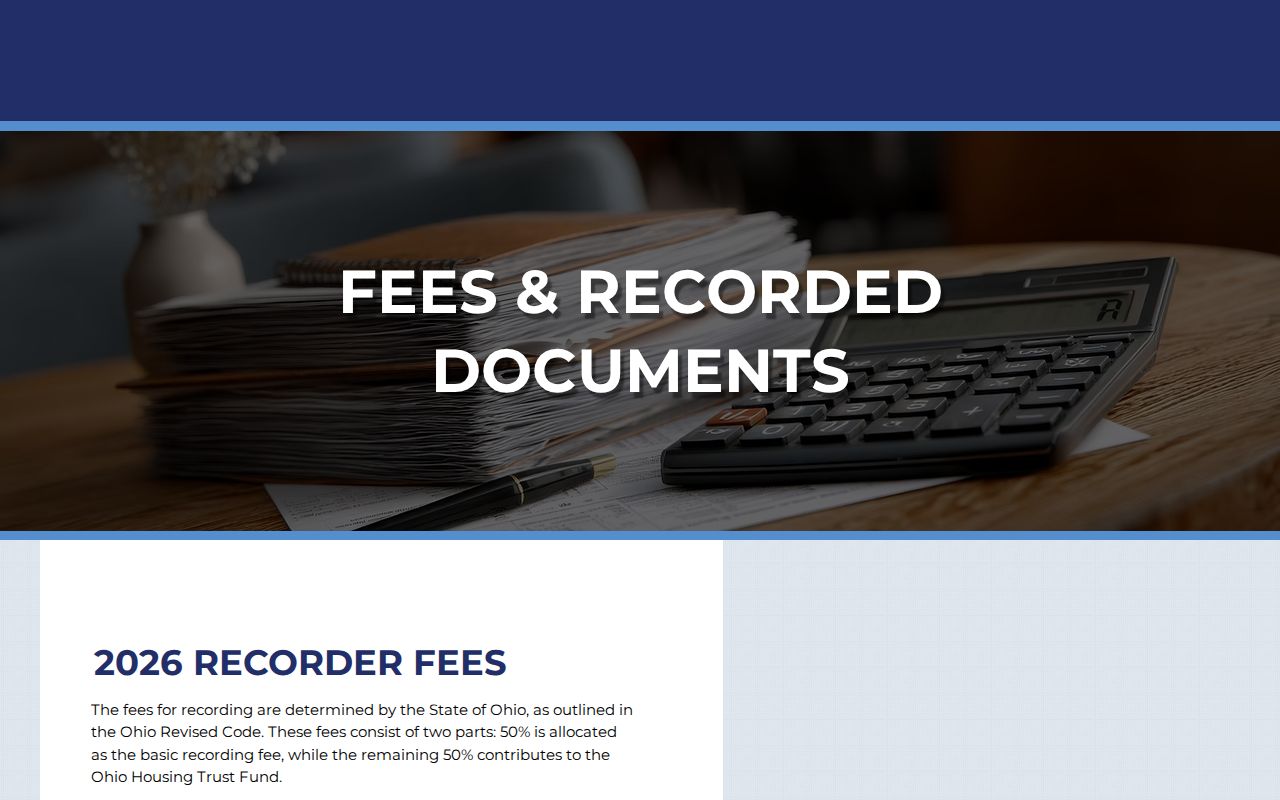
The Recorder notes that a free deed copy may be available through Property Search, while the DTS landing page warns about downloaded purchased images. Check the instrument's current view or checkout state, or ask the Recorder about that particular document.
Former Avon Lake Street Leads
For an older Avon Lake address, library material fills a different role from the county property tools. Avon Lake Public Library documents city and county directories from 1941 through 1961, but calls the run incomplete. It also holds The Press and antecedents from 1928 onward in digital and microform, maps and atlases from 1851 through 2011, and Shore Log yearbooks from 1960 through 2018. Ask staff to check a surname, street form, and year rather than assuming every volume or address survives.
A directory entry can provide a historical name, address, and telephone lead because the information was voluntarily supplied. Pair it with a map, released census, probate file, or recorded instrument before drawing a household conclusion. The collections themselves and their limits are described in more depth in the Avon Lake city directory collections.
Note: An absent directory entry can reflect a missing volume or voluntary omission, not proof that a person was absent from Avon Lake.
Understanding Avon Lake Street Terms
Record labels matter because an Avon Lake street directory trail crosses systems that use different identifiers. Preserve the spelling and punctuation shown by the office. A parcel number is not a ZIP code, and a property location is not automatically the same as a mailing route.
- PPN or parcel number
- The property identifier used to connect the Auditor record to Recorder parcel searching. Enter it in Recorder Advanced Search with dashes removed.
- Situs address
- The street location used to find a parcel. It can differ from an owner's mailing address, and neither label alone establishes occupancy.
- Legal description
- The land description used in Recorder and Tax Map work, such as a subdivision, lot, tract, or other recorded form.
- Instrument
- The Recorder result action that opens a selected recorded document image.
- Recorded party
- A person or organization named in a recorded instrument. The label describes that document relationship, not every person at the address.
- Plat
- A recorded subdivision or other land plan that can help connect a parcel, lot, and legal description to the mapped street context.
- Tax Map
- The county parcel-map and legal-description reference channel used to check a parcel's geographic context.
- City directory lead
- A historical name, address, or telephone reference from a volume, subject to incomplete holdings and voluntary reporting.
Limits of Avon Lake Street Records
An Avon Lake street directory cannot establish a full household or produce a lawful list of everyone on a named street. The recorded owner and a party to a deed are not the same as all occupants. The Auditor route is a property-record entry point. The Recorder is a recorded-document source. Historic directories are incomplete and voluntary. The voter lookup requires a first and last name and does not create a by-street roster. Ohio law also excludes phone, email, Social Security, driver-license or state-ID data, confidential registrations, and protected addresses from ordinary voter disclosure.
Lawful personal use. Avon Lake address records can support family history, estate research, civic questions, and verification with the custodian. Do not use any source to stalk, harass, intimidate, or harm another person; Ohio's menacing-by-stalking law, R.C. 2903.211, can apply to harmful conduct and posts.
Ohio Safe at Home and designated-public-service-worker protections can restrict address disclosure. The Ohio Public Records Act, R.C. 149.43 provides a request path, but it does not override confidentiality statutes or require an office to create a new street list. Verify ambiguous associations with the relevant custodian.